Thursday 22 September 2011

Skye Trail Day Seven

Day 7Torrin to Broadford


Its our last day of the walk and today as my ankle is not too good we going to head to Broadford along the road. We will then pick up a new path that heads down to Broadford.  The main route would have taken us south of Torrin and to Suisnish and Boreaig before heading towards Broadford. This would have put about another 4 miles on the leg.


Tent is very wet as its been raining during the night, but we have blue skies. We make our way back down to the road where we follow it round to the other side to Torrin. Little place with a couple of self-catering cottages, hostel type building and the Blue Café.   Which on Sundays don’t open to 12 noon and we passing it at 10.30.


Not a lot to see on route as we wind along the road. We come across cow in the road.  Further on we come to the ruins at Chill Chriosd. Former church that dates back to the seventh century.  So we sat down enjoyed our lunch here.


Across the road is the old Marble mines and the old railway line has made a new path called the Marble road. Very wide grassy path the contours around the hillside down to Broadford.

The path takes us down pass the Broadford hotel. The original home for Drambuie the whiskey liqueur.  Then we carry onto Broadford Bay. The end of the Skye Trail, which has been a great journey. Walking though some of the best wild countryside you have. Landscape with history and many tales it could tell you. Weather changing the incredibly landscape, with sun, rain and cloud.

To ever who read this may go and enjoy the route me and Helen has done. Even if its only part of it you do. Each section can be changed.

Skye Trail Day Six

Day Six Camasunary to Torrin


We awake and I see what the view is like and unzip the door. Large army of midges waiting for us. So packing up is not going be easy and it wasn’t. By now the ground we were on was very uneven and full of holes. Not a good spot to put a tent.
So packing took a bit longer and for me it took longer as the plastic liners was causing packing problems.

Our route today would take us down the coast and round to Torrin. The cloud base was down to 100/ 200m as we set off.  We had another option of doing a Munroe but we wanted to do the coast. No good going high today. We head away from the beach and find the path that runs along the cliffs above the sea. The path is narrow in places and over grown trees cause a few problems getting though with our rucksacks. Some parts of the path have steep drops straight down to the sea. Just hope we don’t trip. Looking out to sea we can see the small ferryboats taking people to the head of Loch Coruisk. Further along we drop down to a stone beech with a lovely grassy bank at the back. Would have made a great camping spot if we known.


From here we carry on to the small village of Elgol and as we approach we can see a couple of eagles high up above us. Elgol has a scatting of white washed houses as we enter from the top of the village and the carry on down to the small harbour. Which does small fishing boats and the little ferries to Loch Coruisk use. A couple of companies have offices on the quayside.  There is a small café at the top that was closed, but if you go past the toilets you will find the village hall. At the far end are a small shop selling food and a small café. Where we enjoyed home made soup, lemon tart and we had a take away bap. We came across a notice saying that toilets maybe closing down.


The next leg is going to be mostly on roads again.  We leave Elgol and head east along the road and soon we spot a trig point. Off route by 200 yards, but must climb it. It was a tough at 118m high.  From here we head down to the Glasnakille where there is few houses and a B&B.  We are now back with the coastline with different views.
  Follow the road north and soon it comes to an end. We now enter a small wooded area and follow this for about a mile before picking up a small road that leads up the main road to Elgol again. From here its just hard slog along the road to Torrin area. Only place we passed though was Kirkibost. Which housed John mUir office and a Fishery place.  Road was fairly busy at one point and we put it down to the ferry coming in.

As we arrive towards the far end of Loch Slapin we start thinking about camping spots. Again we have eagles flying near but not sure if its Golden or Sea Eagle.
The land start to flatten near a river coming down from the mountains and looked a good spot but DofE got there before us. So we follow the river up into a car park and again we could not find any good ground.  We wander and find another path close to a river and then we find a very small patch of grass. Just of the path hidden under the trees. Good water supply.  So we settle down here for our last night. We had a few gusts to join us. Midges.


Skye Trail Day Five


Day Five Sligachan to Camasunary

Sligachan Campsite


Well what a wild night. Not a lot of sleep due to the heavy rain and gale force winds.  Very surprised that tent still had all the tent pegs in and the guy ropes were still there.  During the night kept having a check though the door as you could hear cars moving and voices.  Once up and out of the tent you could see who was left. Not many.  Some tents have gone others were flat on the ground. Ours were ok and stood the worst we been in with this tent. I think mainly because of the alloy poles and it was low tent.
We went off for Breakfast at the hotel.  Full cooked breakfast for £10 plus all the cereals and toast.  We then checked the forecast again with free wifi and it was showing to clear up with the winds dropping. The case was do we carry on or wait a day. So we packed up and carried on as it looked like it was clearing since we had breakfast.

Our route today was to head down Glen Sligachan, where we have a choice of two routes at a path junction.  One would go right and over to Loch Coruisk and we would camp around there. This is one of the finest lochs with the Cullins as a backdrop. The next day this route would carry on a long the shore and involved the Bad Step.  Due to the wet weather and as the day went on the cloud came back in. We went for the other option as if you slipped on the bad step you would end up in the sea. Big rucksacks and wet rocks did not mix.


Not the Best Walker to meet on a narrow path
 So our route along the Glen took us along the River Sligachan with the dark rock of the Cullins on our right. Being cover with cloud and then showing them selves again. On our left lies the red cuillin. The path is good with a few small burns to cross and few a little deeper with overnight rain. On the path we met a couple coming towards us with a very large fishing rod attached to his rucksack. From his face it looked like they did not catch anything and they had a rough night in the tent.

At the fork in the path we turn left to carry on towards Camasunary our campsite for the night. The paths heads towards Loch  an Athain as four RAF jets thunder low and sweep down the Glen.  We meet a jolly mountain biker who is having fun in the peat bogs and a girl walking towards us, who looks happy but not dress for the mountains.  We come across the girl another 3 times on this trip as she keeps popping up in different areas.  As the path heads towards Loch na Creitheach we were trying to find a river for some water for lunch.  But with all the rain all the rivers seem to under ground or are dried up on this side.   So our pasta mug shots stay in the rucksack and we just have the pate and oatcakes.

As we come over the brow of the hill to Camasunary we can see the white wash lodge and another building further on. Which we found out was a bothy. The land around belongs to the John Muir Trust and the buildings and the bay is in private ownship.
Camasunary
As we head down the path we always start looking spots to camp and water. The only suitable place was on the grass area near the beach or just above the man track next to the river. None of the spots were that good and we choice one little higher up from the track and little out of sight of the lodge. (If we known about it or checked the map we could have walk about 1 mile 2 miles further on and there was a nice spot on another beech)
Wild Camp at Camasunary.
So we set the tent up and have our meal washed down with more red wine. Keep popping our heads out looking at the sea view. Would have been nice if it was not raining and blue sky with a good sunset. So that was not on the cards but what we did get was a stag came down to the beech and was drinking from the river. We were up wind from it and I don’t think it knew we were there. Very large beast it was and tried to take a photo, but the rain was hitting the lens.  So could not get it to focus. If we carried onto the next beech we may well have not seem him

Not the Best Shot. Rain Hitting Lens thowing focus out

Wednesday 21 September 2011

Skye Trail Day Four

Day  Four Portree to Sligachan


We wake up about 7.15 am under a soft duvet.  Had a good night sleep The bed was lovely and then down to a cracking breakfast. Fuel us up for the day. The weather does not look too bad outside.

Monday 19 September 2011

Skye Trail Day Three

Day 3 Bealach a' Chuirm to Portree
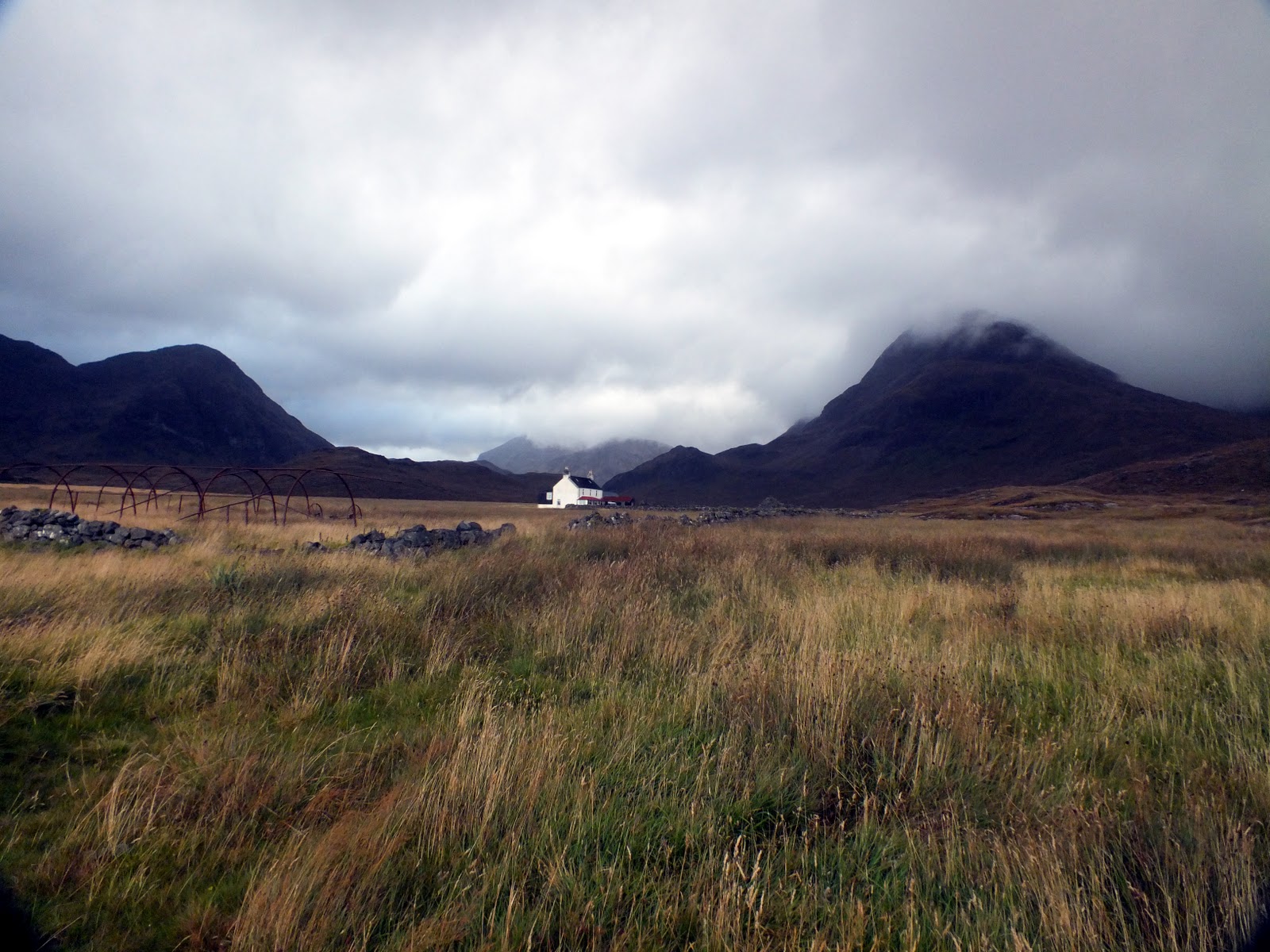
Looking back to Day 2 walk


We a wake to a clear morning.  The hills around are clear, but still damp. Tent is very wet from the rain in the night. Plus the ground is showing puddles.  So stove on and we soon have breakfast. Up on the ridge we have to climb we can see another camper. First thinking it could be the German lads who had second thoughts. But soon looks like one person.
Washing Up
Our Camp
The Path We Found. Just Below. Look for A Figure on Left

So off we go up and around the spur that comes down from the Storr. Would have loved to gone up but we know we have a long day and we need to find this path down. So we head over the crest to the other side of the ridge where we need to turn and follow it along looking out for the path.  This is where it all changes. Just below the ridge is a path that leads towards the Old Man of Storr. It’s a big well-worn path and we can see the other camper on it. Look at the maps and it’s not on any of them even the Harvey map it’s not marked.  There is a path further round on the maps. So we head down a steep slope to join the path, which takes us to Needle Rock and the Old Man.

Old Man


The Storr 719m

Old Man  and The Storr


Looking Back up. Before entering the forest
Weather is still clear with a few swirling clouds. It gives us chance to photograph the Old Man. We met one guy who has been there since 6am waiting for the right shot.  The area is already busy with tourist coming up from the road. None of them kitted out for rough paths or some looking very unfit as the puff pass us.

From The Old man we head down though the forest, but looking around where we could have camped that night. We did not see many places with in the forests we went down. We saw a non-English tent still up and wonder if that was the German guys. 
Rough Going

Rough Ground


Looking Towards Portree

Highest Point of THe DAy

At the road we had a quick break before heading down to a small power station to start the path along the coast cliff edge paths. This is where both routes split. The other route went back up on the Storr and took the high level route, but we wanted to take the cliff route.

What we did not know was how tough this leg would be. There was not much paths on the first half and the going was boggy and lots of heather and tough heavy ground to cross.  The route would take us to Fiurnean 349m and from there it was to get better with shorter grass and easy walking.  We did find shorter grass but the rough boggy ground had zapped the energy out of us.

This was going to be a good ridge walk and I wonder how many people do this ridge, as we did not see a soul.  Our highest point on the ridge was Sitheam Bhealaich Chumhains 392m. This was a steep climb up to it. One of those hills that did not seem that far from the other side but was a killer at the end. From here it headed across some rough and boggy ground again before dropping down to farm fields

Again the weather closed in and we had to watch the cliff edge.  Also a good spot for Sea Eagles but not today.   Once down to the fields we head around them and picked up path signs. The first one since we set off.  It also looked like a new path has been made and this took us on a shorter route into Portree.

Tonight we were going to stay in a B&B and swap cloths over as we left the car in the long stay car park. This is free and we had no problems.  As you walk into Portree there is a few small B&B, which don’t have any rating, but they had rooms. We carried onto the car, as we wanted one where we could leave the car. So we drove out and found one. This was on a Wednesday in September and the 98% had No Vacancies signs up.  Which surprised us as we may had to camp.
B&B

Portree

So nice to have a shower and clean cloths back on. We then headed into the town and ate in the Isles Inn, which you find in the Square. Good food and local beers. Plus the have live music each night.

Skye Trail Day Two

Day 2 Blealach Uige to Bealach a'Chuim


Back on the Ridge line for start of walk.
We wake up a little late, but hey we on holiday and in the middle of no where.. So not many people around. Routine I get up first and then push pack away the sleep bags out of the way.  Jet boil goes on for the morning cuppa.  Breakfast is musli, which has been mixed in with dried milk. So not the best breakfast, but it will have to do. Than quick wash and we start packing our rucksacks for the day. Final thing down is the tent, which is now damp.

The Ridge. What we done so far.
Our aim today is walk back onto the edge and head for the Old Man of Storr. From there our campsite could be next to the forest on the right side as we come down. This depends on flat ground and a water supply.  We may even be camped in the forest. The main problem today will be finding the path down from the ridge to the Old Man. We are not sure if the path will be a scree run path. The maps are not showing the paths clear in around the Storr.
Mini storr

Looking back to the Quiraing in the distance

Beinn Edra 611m
So we set in swirling cloud and little damp in the air. Once on the ridge our first hill is Beinn Edra 611m. Second highest point on the ridge walk.  We started getting better weather now as the clouds break up. We can see our route head of us. This is going to take up and down on the undulating ridge. Small roller coaster walk for us.

Final Hills Coming up. But the weather starting Close in

So we carried on for another three hills where we had a short lunch break on Flasein 599m. This was only so we could get out of the wind. Which I measured at 20mph. Not strong but it was a cold wind at that. So we found shelter behind some rocks. Downside was the drop we were looking down. So we had to be careful not to knock anything over.

After lunch  we dropped down again and then up onto Creag a Lain 609m. On the descent from here there was a change in the weather for us. The cloud slowly rolled in as we headed up Baca Ruadh 639. Then it started to rain. It’s only a shower we thought and would blow over. No it carried on in a long heavy downpour where we had to for the full waterproofs.

With weather going down hill and the visible down to nearly zero we were on micro navigation. Trying to follow the edge with bits of paths that would move away from the ridge. Then would disappear and stop. So we were using bearings and the gps to pick our way along.  We also picked up two young German guys who asked if they could tag a long with us. I have the idea that they seen this walk and also been told about walking this ridge walk. Guidebooks sound good in good weather. But I could not see any map on them.

Hartaval was our next hill, which turned out to be a tough one to do in the rain. From the top we had to drop down to a col and then head up towards the Storr and try to go around the next spur to find the path down.  We arrived in the Bealach a Chuim col and it was at this point I thought it was best to stop. The time was around 615pm. Lashing down with rain and cloud down. My worry was we had to find the path down and once we done that find  a camping spot. This could well put 2Hours on our time. So we camped in the col as there was water supply and fairly flat ground . Two German guys went on. Took a bearing of my map and still not sure if they had a map.
Camp. Taken the next Day

So we set the tent up near the stream. We did try to go further down but we found we had a few cliffs near us to drop down.  We settled down to our mountain house meal. More layers on to keep warm. The rain still battering down on our tent. Main worry was it the first time the tent has been this high up. Would it hold up if the winds get stronger? At one point the clouds cleared and we could see the hill we need to climb the next day and soon it went back into the cloud.  At that point I switch the phone on, not expecting a signal as we were  so high up in the hills, but hey presto we had a signal. When we got the weather forecast the next day, which wasn’t too bad?